Scale-up

Home » Scale-up

AAB PASHI

Aabpashi Scale-up Plan for Efficient Irrigation​

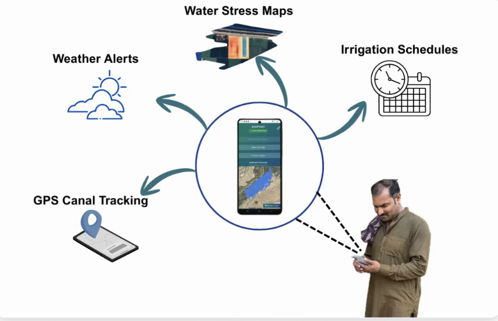
AabPashi combines satellite based water stress analytics,  weather intelligence,  GPS canal detection ,  and irrigation schedules to provide  timely access to weekly canal rotational plan to enhance crop yields, and drive climate resilience—starting in Pakistan, scaling beyond.

Water Stress Maps

Satellite-based alerts flag risky fields before it’s too late.

Weather Alerts

Localized forecasts + smart advisories reduce weather damage.

GPS Canal Tracking

Location Based Canal Detection and Irrigation Schedules

Irrigation Schedules

Weekly Canal schedules from Punjab Irrigation’s Rotational Plan

AAB PASHI

Pilot Operating Divisions

Field pilots validate usability, reliability, and efficiency across varied canal types, regions, and farming practices.

  • Kasur
  • Hakra
  • Pandoki
  • Rahim Yar Khan

Early Signals

Water wastage down, reporting time faster, field coverage rising.

Expansion Landscape

AabPashi's scale-up plan— nationally and regionally—through public-private coalitions and institutional partnerships.